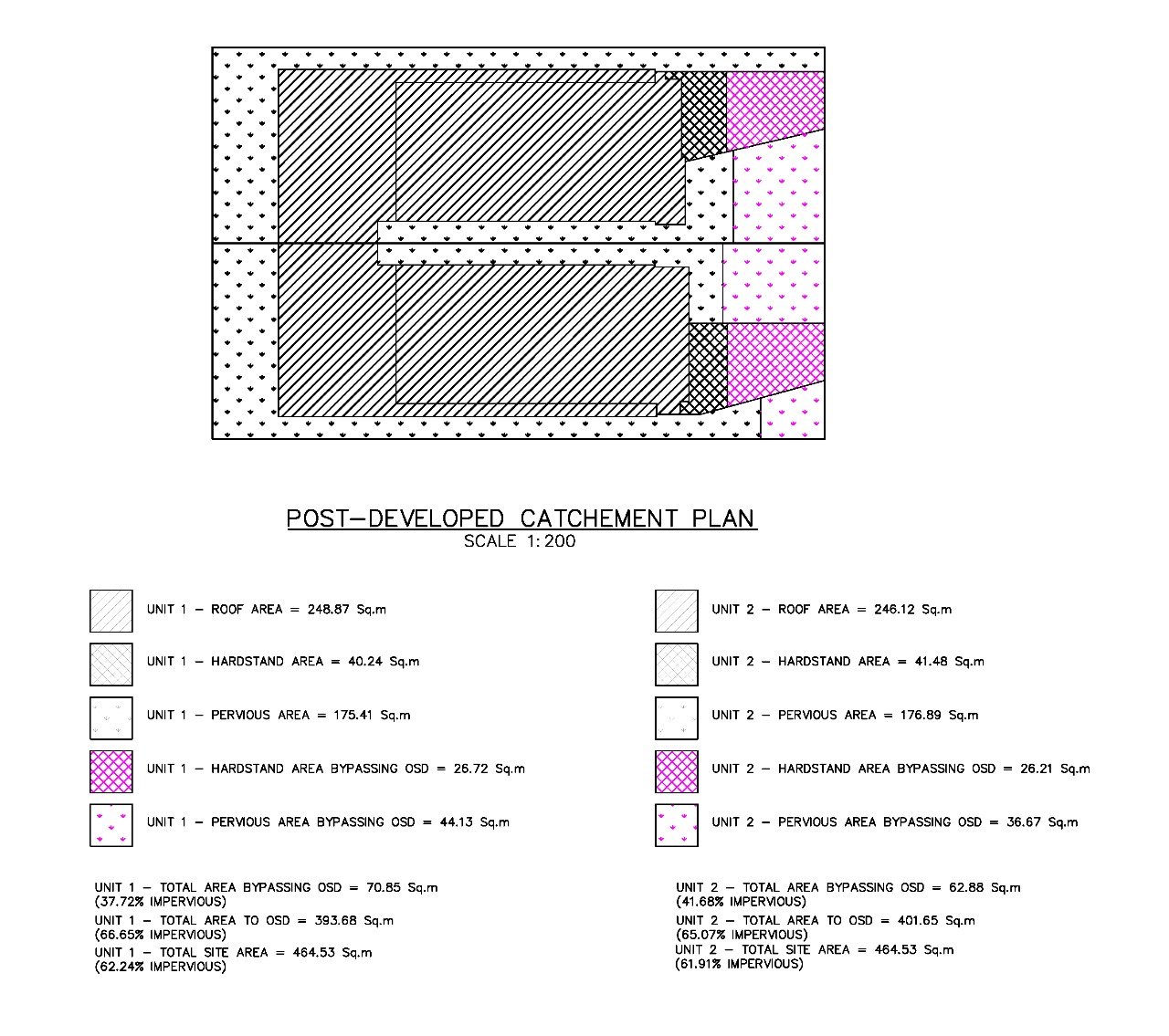
This service provides catchment area mapping, rainfall & runoff analysis, analysis of existing storm water infrastructure, flood prone and water logging area assessment.
Service offered
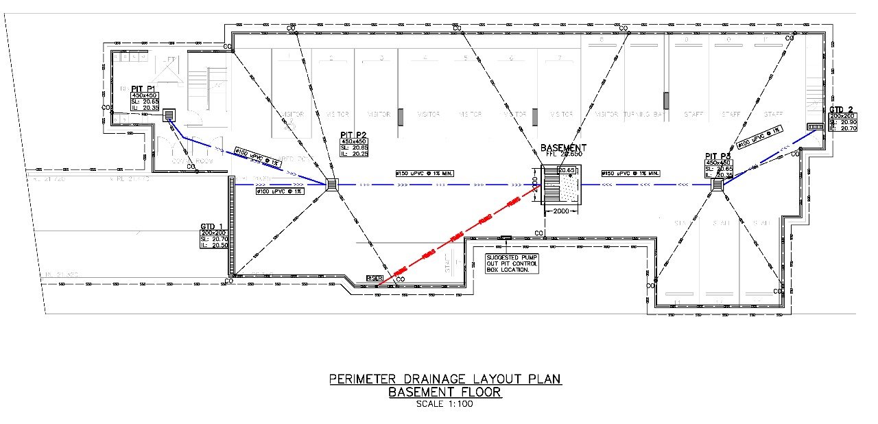
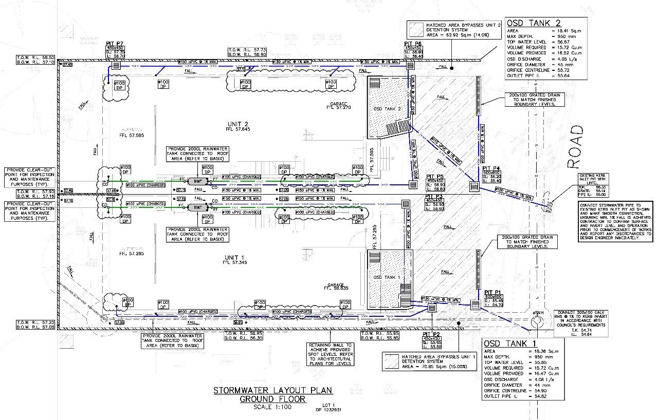
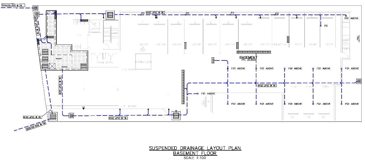
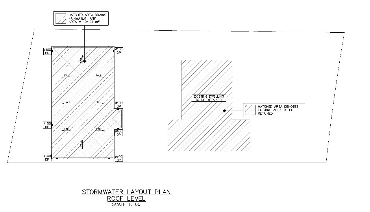
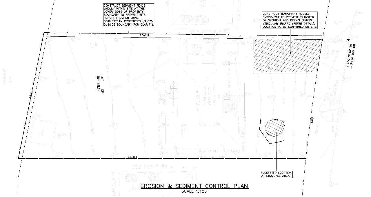
- Preparation of 2D layout plans for stormwater networks
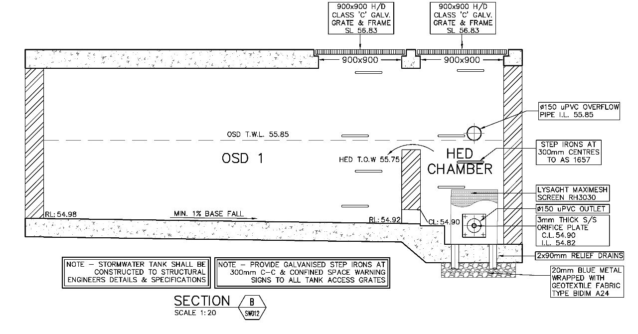
- Longitudinal sections and profiles of drains
- Cross-sectional detailing of channels, manholes, and culverts
- CAD-based drafting of catch basins, inlets, and sump pits
- 3D modeling (BIM/GIS integration) for clash detection and visualization